Friday, August 22, 2014

Dawson City, YK to Iskut, BC

Friday, August 22

On Monday, we left Dawson City for our trip to White Horse.  We had a wonderful time as Rich as posted.  The drive to White Horse was very boring with typical Canadian/Yukon roadways - gravel, holes, dirt and mud.  We stopped in Carmack for a quick overnight before returning to White Horse a town we stopped in on our way North.  The first thing we did upon arrival was to call the "glass doctor" since we all had taken bullets.  Ehlenberg's and Murley's to the RV's and Rich to his toad.  How convenient to have the "glass man" come and do the necessary repairs on sight.

Wednesday, we left our rigs in White Horse and drove to Skagway for the day.  The scenery was very beautiful.  As our timing has been for most of this trip, the morning clouds cleared, sun came out and temps rose as we arrived in Skagway.  Four cruise ships were in port making the town extremely crowded.
Broadway Street in Skagway...note the cruise ship at the far end!
  After lunch and a drive around town, we drove out to the start of the Chilkoot Trial.  We actually walked a tiny bit of it, so now we can say, we have done it.  This is the trial the early miners crossed to get to Dawson City to find their gold.
We did set foot on this historic trail--we did not traverse the entire 33 miles!!

Thursday, we left White Horse retracing our travels back to Baby Nugget Campgound outside of Watson Lake.  This time the campground was dry and warm - certainly much nice then our previous trip when we encountered, rain and mud.  After setting up, we headed into Watson Lake to the "sign forest".  We left our signage in a prominent place and then wandered through looking at all the various signs.  Always hoping to spot one of someone we knew, but that never happened.

At The Sign Forest in Watson Lake, Yukon Territory--we have just added ours signs!

Rich used his wooden "Camelot House" sign and we attached Ehlenberg's and Murley's license plates!!
Later, we saw stars for the first time realizing that our time with the "midnight sun" had come to an end.  Fabulous summer full of tons of memories.

Friday - today we started our trip south down the Cassiar Hwy.  Once again we encountered pot holes, frost heaves, gravel portions and lots of twists and turns, along with narrowness and no shoulders.  We stopped part way here at Jade City mainly for a break in the driving.  We are now crossing paths with folks we've met in other locations.  Am taking advantage of having wifi, which has not been available for several days.

Tomorrow, we are heading to Hyder for the w/e and hopefully see some bears.  We did see 2 driving from White Horse yesterday.  There are lots of signs posted, but very few animals.

Not sure about the next posting - where or by whom.

Jack and Betty will be separating from the group a few days after Hyder.  We will be sorry and not sure how Patti will do without a playmate on a daily basis.

Wednesday, August 20, 2014

Dawson City -- Part II

What We Would Have Missed!!

It would have been a shame to have missed Dawson City!!  As previously reported, we were concerned, and rightfully so, about taking our motorhomes across The Top of the World Highway to get there.  The alternative was to drive from Tok, Alaska, down the Alaska Highway to Whitehorse, Yukon Territory, and then north some 300 miles to Dawson City--making a round trip from Whitehorse (which is on the Alaska Highway, which we needed to travel!) about 700 miles.  Most likely, we would have said, "Nah, let's pass on Dawson City!".  I think all of us would say, "What a miss that would have been!"

As I mentioned in Dawson City -- Part I, we arrived on the Wednesday just as this little village's biggest celebration of the summer was kicking off!  Called Discovery Days, it celebrates the discovery of gold near here in 1896 which set off the Klondike Gold Rush!  We lucked out, as I said, and got into a campground in the heart of town for the whole weekend.  This entire odyssey has been like that--show up somewhere, not knowing what is going on, and falling into a neat "happening"!  And then there is the weather:  we have had lots of inclement weather, but if we need a good weather day to do something, the skies clear and the sun shines, and we "LUCK OUT"!

There were scheduled events going on from Thursday through Sunday.  We walked down to the Visitors Center on Thursday morning, got the agenda, and picked out our "must dos"!  There were lots of them, including the walk along Eight Avenue--the "highest" and last avenue up from the river--which is called Authors' Avenue.  Two famous authors had cabins there just a block or so apart--Jack London and Robert Service.  So, did you read "Call of the Wild"?  Sure enough, we had to go up for the walk along Authors Avenue!

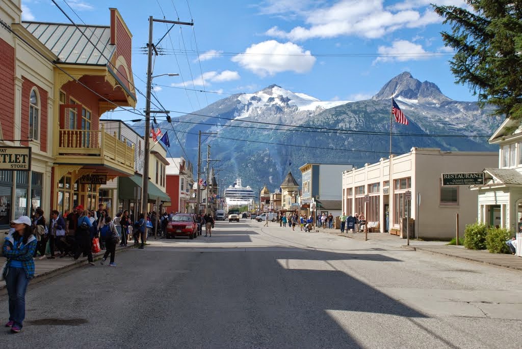
We walked a lot "downtown".  Great restorations have taken place...so many of the old period buildings are now back as they were.  Here is one...famous or infamous, as you may decide!  It is the local gambling hall and "ladies of the night" place...not sure the second part is still in business, but it is a through-back!


In the parade which there is more to follow, here are the dancing girls from Gerties riding on a fire truck...seems appropriate, eh??

Jack, Betty, Tam and Ray recognized the girls!  They went to the show at Diamond Gerties one evening while Ritchie stayed home to work on his computer.  The report?  The little bit heavy lady in the passenger seat sang, and the four girls kicked up their heels.  As someone commented, "Not much"--Betty, was that you??  Jack, of course, had been big on saying the guys should go to the 12:30 show--that's a.m., folks!--because it "got really racy then!".  NOT TO BE!  Ain't one soul in the Alaska Odyssey awake at 12:00 a.m. to walk downtown a few blocks for a racy can-can show!

The Rivers Merge!

A bit of geology and history:  the YUKON River runs from the mountains above Whitehorse, Yukon Territory, 2000 miles north and west to the Bering Sea off the coast of Alaska.  It is navigable from above Whitehorse all the way to the ocean.  Hence, it's importance during the Klondike Gold Rush.  Especially since the Klondike River empties into the Yukon at Dawson City!  And it was just up the Klondike that gold was found in 1896!

The Yukon River comes from the top; the Klondike River comes in from the left.  Dawson City is in the foreground

"Stampeders",  as they called, rushed up to the Yukon Territory by the thousands in 1898 in search of their fortunes in gold.  This was because news of the gold discovery didn't make "the Press" in the Lower 48 until 1897 when the first gold bars from the Klondike arrived in Seattle and San Francisco in July of that year.  The "Gold Crazies" rushed up to Alaska anyway they could.  They came mostly into Skagway, then on foot north across the Chilkoot Trail, down to the Yukon River, to Whitehorse, and then to Dawson City where the gold was--supposedly!  Since its discovery in 1896, most of the land around Dawson City had already been claimed by 1897, so the folks who came rushing in during 1898, left empty handed.
But Dawson City swelled from a few hundred souls to over 40,000 for a brief time.  Imagine:  1898, and your little town gets overwhelmed with thousands of outsiders!!  The pictures from that time are certainly impressive!

We did drive up the Bonanza Creek Road--on which the original gold discovery was made--and stopped at Claim #6 which now belongs to the Klondike Visitors Bureau.  You can stop, get out your gold pans, dig up some dirt from across the road, and wash out the junk to find your fortune!!  The sign there says you can only do this 3 days a month!  We wondered, "Who are the gold police that enforce this???"  There were no video cameras around that we could see, and no Police Cars came by!  Besides, we were miles up the dirt road from the highway in Klondike!  Anyway, we had left our equipment at home, meaning rubber boots and gold pans...but none of these folks in the photo were yelling, "Eureka, I've found it!", so we didn't feel like we had missed out on "digging out our gold!".

Gold panners at Claim #6, Bonanza Creek, Yukon Territory!
So, the folks in photo weren't getting much gold!  Back in the old days, that's the way it was done, but it wasn't very productive.  Come on inventors, mechanics, and innovators:  let's build a machine to do it for us!  Called the Gold Dredge--mentioned in Part I.  Here is a schematic of how mining on the Klondike River and Bonanza Creek suddenly changed!


This is Gold Dredge #6...already mentioned!  She mined a lot of Klondike Gold in her day!
This is more to come about our lovely time in Dawson City...stay tuned, and enjoy!!  Parade and Mud Blogs yet to be documented!!
All our best from the 49th State!
The Alaska Odyssey!!

Sunday, August 17, 2014

Catching up on our travels, the Ehlenbergs and we left Fairbanks two weeks ago and drove to Delta Junction, the official end of the Alaskan Highway, then on to Tok, AK.  Tok is the first community into and out of Alaska on the Alaskan Highway.  It has only two roads, one leading South to Valdez and Anchorage, and one to the North, heading to Fairbanks.  Taking the Alaska Highway, everyone passes through Tok.  We stayed five nights while waiting for Rich to catch up with us, back from his trip to Oregon and the Monaco International Rally.  The weather was very nice while we were there so we were  able to grill our fish for dinner and enjoy evenings out of doors.  The mosquitoes had not caught up with us yet.  There is one restaurant in town, Fast Eddies, which is modern and has very good food. They provide a nightly music program, free of charge.  There were two programs, one a local singer/songwriter who entertained us with his own songs as well as some well known tunes such as North to Alaska.  The other was a Bluegrass groups which we did not hear.

Some interesting information about the area: Tok is the coldest spot in North America, reaching minus 83 F in the winter and has a summer temperature in the mid to upper 80's, therefore, they experience an annual change of up to 160 degrees F.  Their schools don't close for weather unless the temperature drops below minus 50 F.  Vehicles throughout Alaska have electric plugs dangling from the front bumpers to allow keeping the car warm in winter.  Cars have electric heaters installed for the engine block, battery and oil pan.  Most parking lots offer electric outlets in which to plug the vehicle heaters. If there are no heater plugs, you simply don't turn your engine off while shopping or running errands.  Even at that, the mechanical parts such as clutches, brakes and steering get very stiff in the cold.  The local Lions Club has provided an outdoor swimming pool for the residents, the only one we saw in all of our travels.  Their thinking is that many of their residents fish and most cannot swim.  Their hope is to reduce death by drowning.  Also, the town has no official government eliminating the need for lawyers.

We were extremely anxious about traveling the Top of the World Highway from Tok AK to Dawson City, in the Yukon.  People who had driven across had been telling us horror stories about traveling the highway and others were telling us "no big deal, just take it slowly." To add to our anxiety, we had heard that 3 RV's had gone off the edge of the highway just this summer, no guardrails and soft shoulders. To help alleviate our fears, we took a car day trip from Tok to Chicken, then five miles out on the Top of the World Highway.  Other than steep grades (7 and 9 percent), narrow passages and dirt surfaces we thought we could make it across the 170 miles, if it wasn't raining.  The night before we were to leave for Chicken, to stage our trip across to Dawson City, Tok experienced a torrential thunderstorm with heavy rain.  The next morning dawned clear with blue skies and sunshine so we decided to move the coaches to Chicken and see what the next day would bring. We could always drive back to Tok and take the road toward Whitehorse.   Chicken is an extremely small town, population around 50 in the summer, much less in the winter, about 12.  Their claim to fame is gold mining and the book, "Tricia", written by a "lower 48er" who moved there to teach school.  To get from Tok to Dawson City, you must pass through Chicken.  The next day was nice again, blue skies and sunshine, so we anxiously left on our trip across the Top of the World Highway.  Since Canadian Customs didn't open until 9 am,  about 50 miles ahead, we left early to minimize the encounter with oncoming traffic and the need for vehicles to pass us.

Our travel across the highway was somewhat uneventful from a safety standpoint.  We did meet oncoming traffic and stopped or slowed down to let them pass.  However, the road was dusty and very rough in sections necessitating speeds of 25 to 35 mph.  One might question our sanity for taking three luxury motorhomes across such a road but we knew that many of the caravans also crossed the border that way.  The scenery was spectacular, especially on the Canadian side.  At the end of the road was a ferry to take us across the Yukon River to Dawson City.  The ferry is provided free of charge by the Yukon government, the only way to complete the trip.  We were very relieved once we arrived in Dawson City but decide it was an experience we never wanted to repeat.

Rich's coach being loaded on ferry


Rich's coach going across Yukon River

Dawson City -- Part I

A Quaint Little Village

What a "find"!  We had heard some chatter about Dawson City which is in the heart of the Klondike Gold Rush country, and were told not to miss it--sure glad we had good weather to come over The Top of the World Highway, for had we not been able to come that way, we might have passed on going around the long way to reach it!
And as has been so true all throughout this trip, we happened to stop here just as a major summer celebration was getting underway--Discovery Days!  So we put down our jacks and settled in for the five days of community activities, including our third community parade!

The Gold Rush Campground we lucked into is right in the heart of town and we could walk to most events and restaurants--but then, the town is not all that big, measuring about 8 blocks up from the river by 14 blocks along the river.  All the streets except for Front Street which is the main road along the Yukon River bank are gravel--or more like dirt!

Looking southeast along Fourth Avenue in Dawson City
The office and store of Gold Rush Campground--lovely flowers

One of the "famous" restaurants in Dawson City

The restored Post Office...a new one was built some blocks away!

Dawson City was the center for much of the Klondike Gold Rush which kicked off in 1898.  The village swelled to over 40,000 people who rushed to the Yukon Territory in search of their fortunes.  Most returned back to their homes after the disappointment of arriving here only to find nearly all the land already staked as gold claims by the prospectors who had arrived in 1897.  The news of the gold strike was slow to reach the outside world.
The village is located at the junction of the Yukon River and the Klondike River, and it was up on a creek off of the Klondike (Bonanza Creek) that the first gold discovery was made.  We drove up the gravel road to visit the largest gold dredge in North America.

This is Dredge #4 on Bonanza Creek

This is the digging end of the dredge...the arm was lowered into the earth and big buckets scooped up the gravel and hoisted it into the working environs of the dredge where it was filtered and washed to gather the gold dust.
The dredge had been working the Klondike River.  It was reassembled at the mouth of Bonanza Creek, and began working its way up the creek.  Its final resting place is 7.8 miles up the valley from the Klondike River.  All along the drive up the valley, piles and piles of gravel and large rocks are strewn all across the valley.  The dredge floated in its own self-made pond by digging up the gravel in front of it and spewing out the "tailings" from the rear.  The creek waters were diverted into the pond so the dredge could use the water to wash down the diggings to get out the gold flakes.  It was slow going...only moving forward by a fraction of a meter a day.

[Time to go to a "mud blog"....more to come later!!]

Saturday, August 16, 2014

Top of the World Highway

From Chicken, AK, to Dawson City, Yukon Territory

This post will be mostly pictures of our trip across The Top of the World Highway which runs from Chicken, Alaska, across the border with Canada, and down to the famous little town of Dawson City, Yukon Territory.  We pushed off early--about 7:30 a.m.--so as to get a jump on traffic either going to Dawson City, or coming the opposite direction.  The highway is strung across the hilltops and ridges rather than running along riverbeds and streams down in the valleys, and it is therefore perched along some pretty high places with major drop-offs on either side of what is a mostly narrow road.  The surface was almost completely dirt and gravel--a map showed the portion from the border to Dawson City as paved, but it was pretty much all unpaved.  Our coaches didn't get too dusted up, but boy, our cars were sure covered in fine clay colored dirt!  And the fine little dust did manage to drift into the coaches--you could feel it on every surface!!
That's Ritchie's coach putting up a dust cloud!  You can see how narrow the roadway is!
We could see lakes, ponds, and river beds below us

A river winds along the valley floor

We could often see mountains way off in the distance
 The wilderness that is much of Alaska and the Yukon Territory was certainly very evident as we drove across the "top of the world".  Unfortunately, we didn't see any wild life! 
A fork in the road about 8 miles west of the Alaska/Canadian border!


The highway goes up and down hills--that's the road off to the left!

Ray let Ritchie get on up the road some to try to avoid eating too much dust!

A highway maintenance yard up ahead


The Alaska Odyssey caravan leaves Alaska and enters the Yukon Territory

Still up on the high ground above the rivers and streams that feed the Yukon River


More dust and gravel!

The views were panoramic but void of snow covered mountains


Eventually, we ran out of ridges and began the descent into the Yukon River valley

That's the mighty Yukon River coming north from Whitehorse

And suddenly, there was Dawson City just below us!

The Top of the World Highway ends across the river from Dawson City--only way across is by ferry!

Ritchie's Camelot House is "on the river"!

And that's the far shore ferry landing at Dawson City!
Many thanks to Tam Murley for all of these photos!!!  We made the journey without incident--and while we are happy to have done it, we won't be seen on this highway again!!  Once is enough!

Friday, August 15, 2014

Tok to Chicken

Top of The World Highway?  Or No!

Hey, y'all blog viewers!  Sorry that we have been a week without a post...I have been remiss in that regard, so I will try to catch up on our travels and experiences...a bunch, for sure!

As you probably know by now, I had to go to Oregon for a RV meeting.  Flew there because of my travel companions insistent argument that it was too long a drive alone--about 8 or 9 days from Fairbanks to Oregon!  And then back up to wherever to meet up with them, and in the mean time, missing some travels to interesting places.  So, flew to Oregon, did the RV meeting, flew back to Fairbanks, hooked up the JEEP and caught up with the mainstream of the Alaska Odyssey in Tok, Alaska, where they had been languishing for a day or two waiting for Camelot House to rejoin our "mini-caravan".

Well, not totally languishing!  They did drive up to Chicken--renamed from Ptarmigan because the founders couldn't spell Ptarmigan!--in a car and out onto the Top of the World Highway for 5 miles or so.  The consensus of the Alaska Odyssey group was to look at the road and make a decision if we should take the motorhomes across The Top Of The World Highway...one of the "to do" items in Alaska, supposedly!  Advice from all quarters whom we asked:  50 percent said "NO, NEVER!" and the other 50 percent said "NO PROBLEM!".  There was no in between.  However, stern advice was given:  don't go if it is raining!  Checked the weather forecast:  looks good!  So decision made:  drive up to Chicken, stay the night, and head out across The Top of the World the next day!  Good decision, because we had a night in Chicken, Alaska, and clear skies the next day!

As to Chicken, population only about 1,000 plus but there are two big campgrounds because the Fantasy and Adventure Caravans stop here!  And other crazies like us who have big motorcoaches and have this 'death wish' to drive across miles of dirt/gravel top of mountain roads with no guard rails!
This symbol for the town sits atop a hill in one of the campgrounds.  Note the gold dredge in the background.

Imagine the size of the egg could this bird lay one!!
The campground we used was pretty Spartan...we didn't use any hookups because we only were staying one night, so dry camping was the order for the day.
This is the campground office and store

Back in it's day, this was a working dredge used to mine the placer gold.

The Alaska Odyssey caravan parked in Chicken!
There isn't much to the town itself:  it is a stopping place for RV caravans and bus tours coming and going across The Top of the World Highway.  This next set of pictures sums up the "downtown"!!


This is the "main" section of downtown Chicken--a café, saloon, and liquor store!

The saloon is a hoot--a few tables, a bar with about 8 bar stools, and a pool table.
Once you step over the threshold, you are greeting by a ceiling and walls covered with hats and ladies panties!


Most of these items have been hanging for a good while--the panties are tattered and ripped!
We arrived at the campground in gray cloudy skies after a short drive up from Tok.  But the forecast for later in the day and for the next day was promising:  we hoped the sunshine would dry out the gravel portions of the Top of the World road.  We did enjoy sitting out in the afternoon as we anticipated the next day's adventure.

Somewhere along the way in our travels in Alaska, we were told that summer is over when the fireweed blooms its top blossom.  The fireweed flower opens its blossoms from the bottom up.  There was a large patch of fireweed in the campground and any number of the plants had bloomed all the way to the top...summer must be nearing its end if the myth is correct!


So much for our brief stay in Chicken...tomorrow it is off across the Top of the World Highway as we leave Alaska and journey to Dawson City, Yukon Territory, Canada.  We have had a wonderful stay in the 49th State and we will carry fond memories of our many experiences with us as we begin the trip back to the lower 48!